Terribly underserved

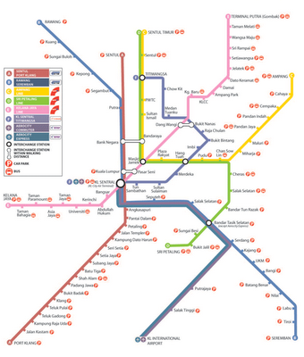
The ubiquitous Rail Transit Map gives the appearance that the Valley is well served and covered.

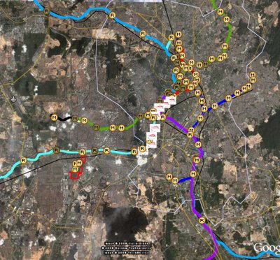
Well with Google Earth, we can now have a much clearer view of how we have fallen behind over the years in leaving parts of the Klang Valley terribly underserved by these mass people movers.
The southwest corridor of Subang, Sunway and Puchong looks pathetically uncovered.
The nortwest area of Damansara, north Petaling Jaya and Bukit Lanjan is strangely empty.
In the north most of Setapak, Gombak, Wangsa Maju, Selayang and Batu Caves are far away from stations.
In the southeast, again, most of Cheras and Kajang are too far away from the arteries.
I don't have to show you what Shah Alam and Klang look like.
Thank Allah that Najib has just recently announced extensions and new lines in the Damansara, Subang Jaya, Puchong and Cheras corridors. Whether the announcements were just an aftertought due to the shit going on in UMNO or the increasing loudness of grumbles due to rising prices is for another time and place.
Even then, I don't think these extensions are enough. Many areas would remain underserved, like Kepong, Shah Alam, Klang, Setapak, Batu Caves and Selayang.
Admittedly, not all areas can be covered, due to land scarcity and the costs involved. But as long as they can continue to find the land and resources to construct expressways and not mass transportation systems, we know they are just bluffing.


0 Comments:
Post a Comment
<< Home